
Due to the Philippines’ geographical location, the country is prone to tropical cyclones which generally produce heavy rains and flooding of large areas.
Metro Manila, as the country’s political, economical, and educational center, and being the most densely populated region comprising 16 highly urbanized cities, has several identified flood-prone areas.
Therefore, if you are thinking of traveling around Metro Manila during the rainy day season, here’s the list of the cities – including highways and streets, that you might want to have a glimpse of to avoid getting stranded over flooded roads.
Manila, Makati, and Mandaluyong are the top three flood-prone cities in Metro Manila, according to the social navigation app, Waze. Moreover, Thinking Machines, a data-science consultancy firm added Pasay City, Pasig City, and San Juan City among others. Here’s their full list of the flood-prone cities in Metro Manila:
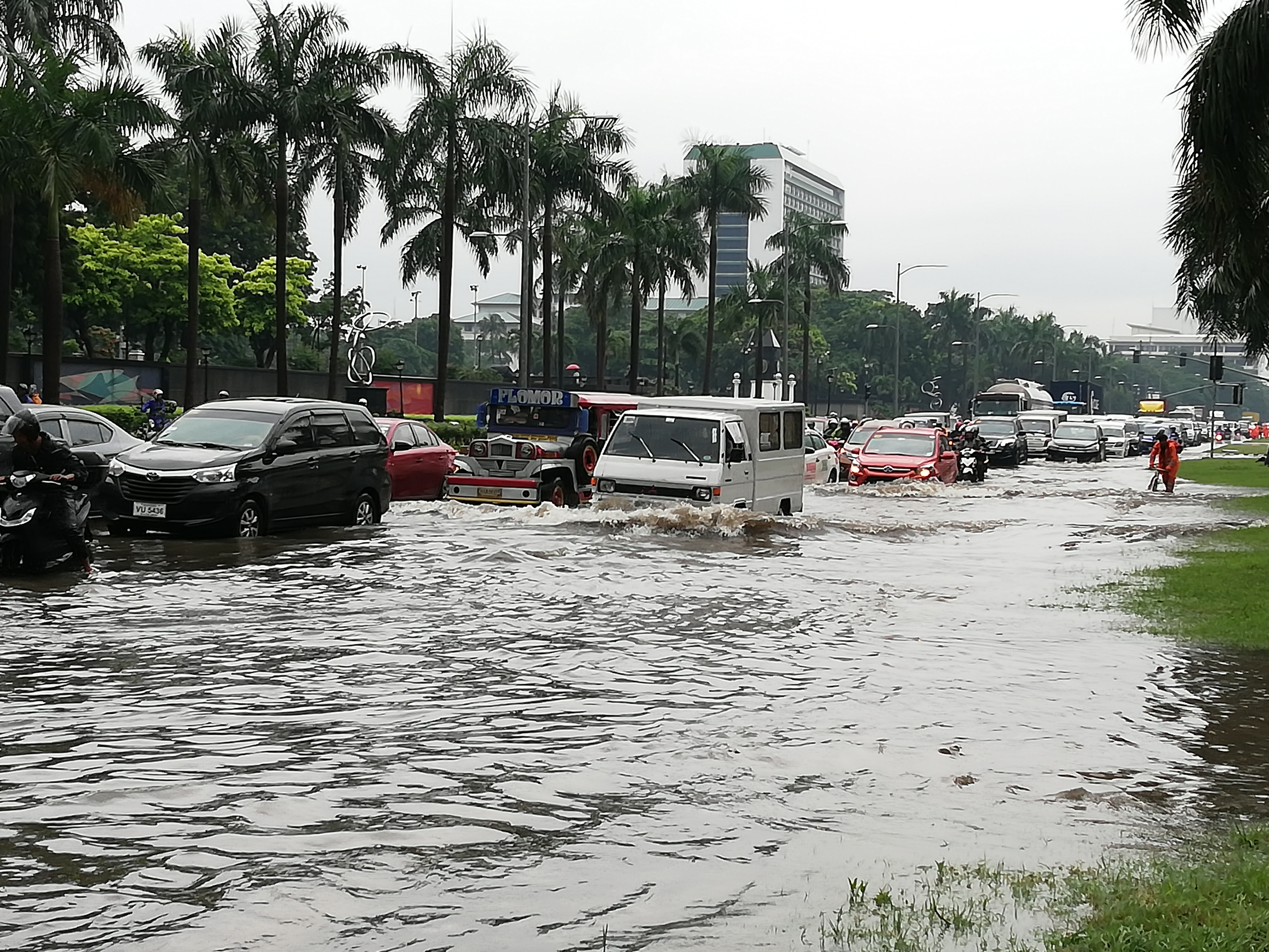
Photo courtesy: Philippine News Agency
10 most flood-prone cities in Metro Manila
Manila
Makati
Mandaluyong
Pasay
San Juan
Quezon City
Taguig
Las Pinas
Navotas
Pasig
In addition to this, a recent study by the Metropolitan Manila Development Authority (MMDA) reveals that Metro Manila is prone to floods, not just because of the rising seas, but also if dumped with an hour of continuous rain.
The MMDA identified the City of Manila as having the highest number of flood-prone streets among the 16 highly urbanized cities in the National Capital Region (NCR).
Subsequently, MMDA also tagged Quezon City as having the second-highest number of flood-prone areas, followed by Makati City and Pasay.
Furthermore, Marikina City, where one of the biggest pumping stations of MMDA is located, is a catch basin of water coming from Quezon City and the province of Rizal, making it also a flood-prone area.
Flood-prone streets
Inadequate drainage capacity was identified as the cause of the flooding in the following areas:
Manila
corner of Quirino Avenue and Pedro Gil,
Dapitan Street/ Basilio to Casanas Street,
Maceda Street/ Maria Clara to Makiling Streets,
Ramon Magsaysay/Ampil Street to Magsaysay Flyover,
España Lacson Street to Blumentritt,
Taft Avenue from UN to Vito Cruz,
Roxas Boulevard-Raja Sulayman,
V. Mapa from Guadalcanal to Old Sta. Mesa Street, and
Quirino Avenue eastbound from Angel Linao to Estero de Paco.
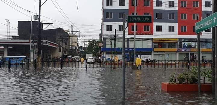
ESPAÑA Boulevard in Manila. Photo by Twitter user @PieIncha
Quezon City
EDSA-Quezon Avenue corner Centris,
Quezon Avenue near Biak na Bato,
Tandang Sora corner Congressional Avenue, and
CP Garcia Katipunan corner UP Diliman.
Meanwhile, the presence of informal settlers along estuaries was the cause of flooding on these streets:
Manila
A. Mendoza street/Remigio to Bambang streets,
Laon Laan street/ Lacson Avenue to A. Mendoza street,
Dimasalang street/Lacson to VG Cruz,
Abad Santos Tayuman, and
Abad Santos Yuseco.
How’s the flood situation in your area?
CITATIONS
Laurel, D. (2019, July 5). The 10 most flood-prone cities in Metro Manila according to Waze. Top Gear Philippines. https://www.topgear.com.ph/news/motoring-news/10-most-flood-prone-cities-waze-a962-20190705
Cayabyab, M. J. (2019, November 13). Manila has NCR’s most flood-prone streets – MMDA. PhilStar. https://www.philstar.com/nation/2019/11/13/1968245/manila-has-ncrs-most-flood-prone-streets-mmda
MMDA Gears Up for Rainy Season; Ensures Fully Operational Pumping Stations. (2021, June 2). MMDA. https://mmda.gov.ph/77-news/news-2021/4670-june-2-2021-mmda-gears-up-for-rainy-season-ensures-fully-operational-pumping-stations.html
MMDA Chair Abalos: Pumping Stations Must Be Ready Before Rainy Season. (2021, January 15). MMDA. https://mmda.gov.ph/77-news/news-2021/4450-january-15-2021-mmda-chair-abalos-pumping-stations-must-be-ready-before-rainy-season.html
![]()
![]()


